
 |
Your land surveyed with Brent Trail Surveying Services Ltd |
Before you contemplate adjusting the boundary with your neighbour it would pay to find out where the boundary lies in the first place.
On more than one occasion surveyors have been called in to relocate a boundary, only to find it was already near where they wanted it moved to.
A common example of this is where there’s been a handshake agreement between earlier owners to fence a more practical line.
This may have allowed better access to a neighbour by sharing a safer entrance and cutting across your land to their house, or it might have been a give-and-take agreement over an entire boundary line.
A give-and-take fence was often established where it was impractical to fence the boundary, due to a shelterbelt located near the boundary or the true boundary traversing some difficult country.
Council’s GIS
Sometimes you can check your boundaries online on a council’s Geographic Information System. But beware, some of these systems can be out by a ‘country mile’.
Generally, if the boundaries line up around your entire property and match your fences, they can be relied upon.
However, there are cases where there will be some major anomalies in this data.
This is common in remote rural areas where there has been little recent surveying work, but can also be the case in some smaller urban areas.
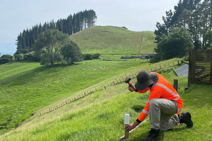 Boundaries can be pegged by a licensed cadastral surveyor.
If your fences don’t fit with your understanding of the boundaries, a browse of council’s GIS Maps might be your first port of call.
Then, with some idea, you could have a good search for the pegs.
Remember that if they are very old, they are often below the ground surface and the only resemblance of a wooden peg might be the straight vertical remains of its centre.
If you can’t find the pegs
If you can’t find your pegs and you want to re-fence the boundary or indeed relocate the legal boundary you will need to call a local surveying company and have the boundaries pegged by a licensed cadastral surveyor.
These surveyors are experienced in all things boundary and are licensed by the Government to place legal survey pegs on existing and proposed new boundaries.
In all but extraordinary circumstances, boundaries between adjacent titles can be moved, and the size and shape of the sections can be changed within prescribed limits, according to the respective council rules and regulations.
In the rural area, titles can often be relocated to a completely different place on your farm.
This gives you the ability to develop your property in a different way from previous owners – perhaps moving existing titles to a position where their sale and occupation might result in fewer effects on your farming operation.
If you are keen to find exactly where your legal boundaries are located or change your boundaries between titles, feel free to give us a call and discuss the options – we can even supply data to correct your boundaries on a council’s GIS system.
Our team of specialists are ready to hear from you today!
0 Comments
Leave a Comment